
Expertise
Advance Mapping & GIS

Advance Mapping & GIS
We specialize in Advanced Mapping & GIS Services, delivering precise, data-driven spatial solutions for urban planning and infrastructure development. Our expertise includes Land Use & Zoning Maps, which provide accurate insights into spatial patterns, aiding in effective planning and resource management. Through Thematic Mapping, we visualize complex data sets, offering valuable insights for decision-making. Our Remote Sensing & Satellite Imagery services enable large-scale environmental monitoring and land assessment, ensuring accuracy and efficiency.
We leverage Drone Mapping for high-resolution aerial surveys, capturing detailed terrain data for accurate analysis and planning. Our Digitization & Georeferencing of Maps converts paper-based maps into digital formats, enhancing accessibility and precision. We also offer Land Information & Cadastral Mapping, providing detailed land records essential for property management and legal compliance. Additionally, our Telecommunications & Utility Mapping services support infrastructure planning by accurately mapping networks and utilities, improving operational efficiency.
With cutting-edge GIS technology and data analytics, we deliver reliable, scalable, and insightful mapping solutions, empowering smarter, more sustainable, and efficient urban planning and management.
Advance Mapping & GIS
Urban Planning on GIS
We specialize in GIS-powered urban planning, delivering data-driven solutions for smarter, sustainable city growth. Our expertise includes land use mapping, dynamic visualization, and real-time analysis, enabling efficient decision-making and improved infrastructure management. With accurate geospatial insights, we help cities become more resilient, efficient, and future-ready. Through precision mapping, spatial analysis, and advanced GIS solutions, we create smart, sustainable, and well-structured urban environments, ensuring future-ready development.
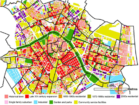
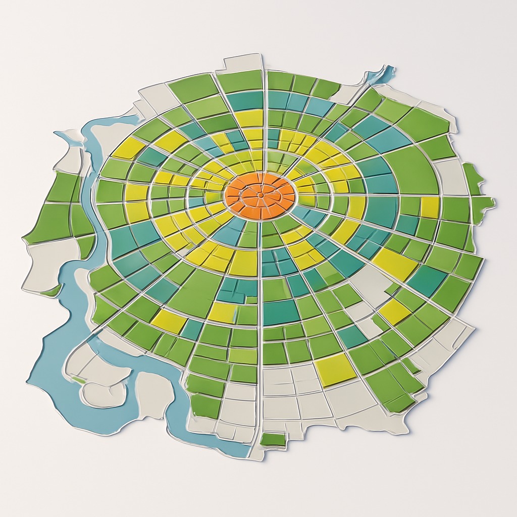
Land Use & Zoning Maps
We specialize in Land Use & Zoning Maps, providing precise spatial analysis to guide urban growth, infrastructure planning, and regulatory compliance. Our expertise ensures optimized land allocation, balancing residential, commercial, industrial, and green spaces for sustainable city development. Using advanced GIS technology, we create highly accurate zoning maps that support smart planning, efficient land management, and policy enforcement. Our solutions enable data-driven decision-making, ensuring organized expansion, controlled density, and environmental sustainability in urban areas.
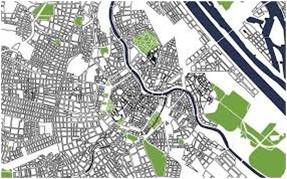
Thematic Mapping
We specialize in Thematic Mapping, delivering detailed spatial insights for urban planning, policy-making, and infrastructure development. By visualizing demographics, land use patterns, transportation networks, and environmental data, we enable data-driven decision-making. Using advanced GIS technology, we create accurate, visually impactful maps that reveal trends, disparities, and growth patterns, supporting efficient planning and resource management. Our thematic maps empower cities with clear, actionable insights for sustainable and organized urban growth.

Remote Sensing & Satellite Imagery
We specialize in Remote Sensing & Satellite Imagery, providing high-resolution spatial data for urban planning, land assessment, and environmental monitoring. By capturing accurate, real-time imagery, we enable precise analysis of land use changes, infrastructure development, and natural resource management. Using advanced geospatial technology, we generate detailed maps and reports, supporting data-driven decision-making. Our solutions empower cities with accurate insights for sustainable growth, disaster management, and future-ready urban planning.

Drone Mapping
Drone mapping technology enhances consultancy services by providing high-resolution aerial imagery, 3D modeling, and geospatial data for urban planning. It aids in land use planning, infrastructure development, and smart city projects. Drones improve transport planning, environmental monitoring, and disaster management. They support real estate valuation, slum rehabilitation, and heritage site preservation. Consultants use drone surveys for accurate topographic assessments and construction monitoring. Overall, drone technology ensures efficient, data-driven, and cost-effective urban development solutions.
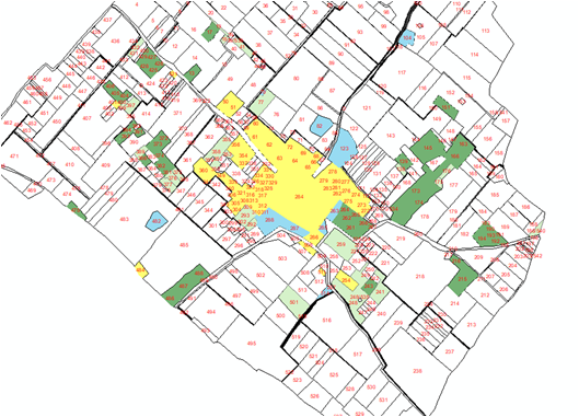
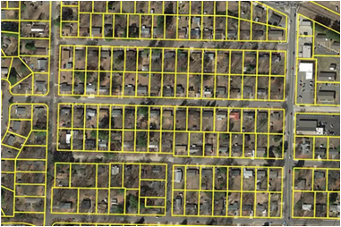
Land Information & Cadastral Mapping
We specialize in Land Information & Cadastral Mapping, providing precise, geo-referenced parcel-level data for urban planning, land administration, and property management. Our services include accurate mapping of boundaries, ownership details, and land use patterns, ensuring legal compliance and efficient governance. Using advanced GIS technology, we create detailed cadastral maps and databases, supporting land records management, dispute resolution, and infrastructure planning. Our solutions empower cities with reliable, transparent, and efficient land management systems.
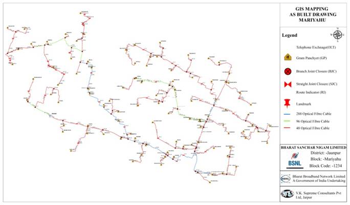
Telecommunications & Utility Mapping
We specialize in Telecommunications & Utility Mapping, delivering precise, geo-referenced maps for network infrastructure planning and management. Our services include accurate mapping of telecom lines, electricity grids, water pipelines, and gas networks, ensuring efficient asset management and maintenance. Using advanced GIS technology, we create detailed utility maps and spatial databases, supporting infrastructure expansion, fault detection, and service optimization. Our solutions empower cities with efficient, reliable, and future-ready utility management systems.
Digitization & Georeferencing of Maps
We specialize in Digitization & Georeferencing of Maps, transforming paper-based and legacy maps into accurate digital formats for urban planning and infrastructure management. By applying precise georeferencing techniques, we align maps with real-world coordinates, ensuring spatial accuracy and seamless GIS integration. Our services enable efficient data accessibility, enhanced visualization, and streamlined analysis, supporting data-driven decision-making. With accurate, geo-referenced digital maps, we empower cities with efficient land management and future-ready planning solutions.
Read More
The Advanced Mapping & GIS Projects empower cities with precise spatial insights and data-driven solutions, enabling smarter urban planning and infrastructure management. By leveraging cutting-edge GIS technology, remote sensing, and drone mapping, we capture and analyze complex geographical data with unparalleled accuracy. Land Information & Cadastral Mapping solutions provide geo-referenced parcel-level records with ownership details, supporting efficient land management and legal compliance. Additionally, we offer Telecommunications & Utility Mapping, accurately mapping network layouts for water, electricity, gas, and telecom lines, aiding in efficient infrastructure planning and asset management. Our projects focus on land use analysis, cadastral mapping, utility network visualization, and thematic mapping, providing valuable insights for decision-making and sustainable growth. Through high-resolution satellite imagery, 3D models, and interactive web maps, we deliver reliable, scalable, and future-ready geospatial solutions that enhance efficiency, transparency, and resilience in urban development.
Service offered by us
Our company offers comprehensive Advanced Mapping & GIS services, including land use and zoning mapping, providing detailed spatial insights for development planning and regulatory compliance. We specialize in thematic mapping, visualizing complex datasets like demographics, infrastructure, and environmental trends for data-driven decision-making. Our remote sensing and satellite imagery services capture high-resolution data for large-scale land assessment, change detection, and environmental monitoring.
We also provide drone mapping, delivering high-precision aerial surveys, 3D terrain models, orthomosaic maps, and digital elevation models (DEM) for accurate spatial analysis. With digitization and georeferencing, we transform traditional maps into precise, GIS-compatible digital formats, ensuring seamless data integration.
Additionally, we offer land information and cadastral mapping, generating parcel-level records with ownership details for efficient land management and legal compliance. Our telecommunications and utility mapping services accurately chart network layouts for water, electricity, gas, and telecom infrastructure, supporting effective planning and asset management.